A warning has been raised that navigation accuracy for aircraft and drones could be significantly disrupted in the future. Unlike GPS, which provides location information, electronic compasses that determine direction rely on an Earth magnetic field model, and critics say the benchmark data is rapidly becoming outdated. On April 4 local time, IT outlet TechRadar spotlighted these risk factors.
The key is the World Magnetic Model (WMM). The model is used as a standard for compass functions built into most electronic devices such as smartphones and smartwatches. David Roy-Guay (데이비드 로이-게이), founder of Canadian quantum sensing company SBQuantum, said, "The WMM effectively powers all electronic compasses." If GPS tells you where you are, a WMM-based compass provides direction, enabling map apps to show the direction of travel, he said.
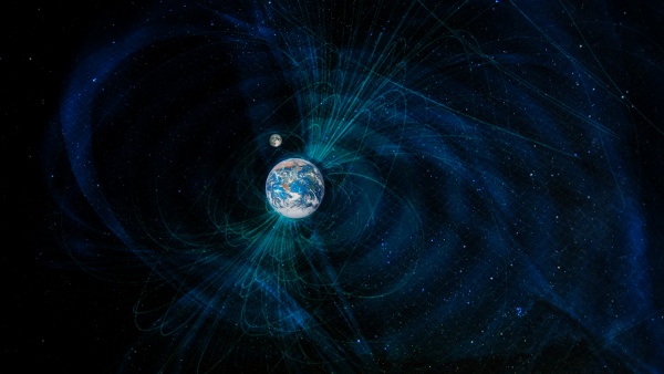
The problem is that Earth’s magnetic field is constantly changing. The north magnetic pole moves every year, and this is shortening the WMM’s effective lifespan. While the model was typically updated every 5 years, the pace of change has accelerated and there has been a case where it was revised after 4 years. That means direction errors can accumulate if the model does not sufficiently reflect reality.
Limits in observation infrastructure are also increasing the risk. Concern is rising that if the European Space Agency's (ESA) Earth magnetic field research mission Swarm ends, the reliability of existing magnetic field data could drop sharply. Roy-Guay warned that "the current map could effectively become useless within 2 to 3 years," pointing to the possibility that navigation systems for aircraft and drones could deviate significantly. He said direction errors could reach tens of degrees in polar regions. In Alaska, there has been a case where an airport changed runway numbers due to magnetic field changes.
The U.S. government has also moved to respond to address the problem. The National Geospatial-Intelligence Agency (NGA) began the MagQuest Challenge in 2019 to identify next-generation magnetic sensing technologies. The goal is to shift from data collected intermittently to a continuous observation system that is close to real time.
In this process, SBQuantum has drawn attention. The company developed a quantum physics-based "diamond magnetometer" and introduced a small sensor that can measure magnetic fields with very high sensitivity. The technology is being tested through a space-deployed platform, Diamond Polaris–1, and is expected over the long term to become a basis for continuously monitoring Earth’s magnetic field.
The collected data will be analysed by the National Oceanic and Atmospheric Administration (NOAA) and the NGA and reflected in future WMM revisions. The company said that even though data quality is still at an early stage, it is usable for compass applications. It also suggested that deploying satellites or drones at various altitudes could build a more precise magnetic field map, making it possible to correct inertial navigation systems (INS) or achieve location accuracy of up to about 100 metres without GPS.
The technology is still at an early stage. More time is needed for sensor miniaturisation and commercialisation, and the goal has been set to reduce it to about matchbox size within about 3 years.
Experts say that if changes in Earth’s magnetic field overlap with observation gaps, the impact could extend beyond simple smartphone direction display errors to affect overall navigation for aircraft and drones. This is putting the development of a more precise and continuous magnetic field observation system at the centre of future navigation technology tasks.