After conditional approval for Google to export 1:5,000 high-precision maps, South Korea's geospatial information industry and academia gathered at the National Assembly to discuss follow-up responses.
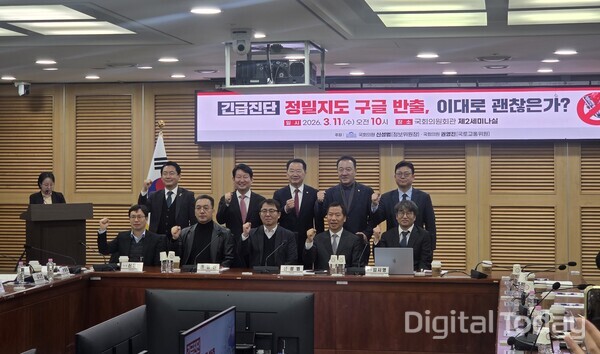
Shin Sung-bum (신성범), chairman of the National Assembly Intelligence Committee, and Kwon Young-jin (권영진), a lawmaker on the Land, Infrastructure and Transport Committee, jointly hosted a discussion titled "Emergency diagnosis: Google export of high-precision maps, is this acceptable as it is?" on March 11 at the National Assembly Members' Office Building. It was the first open discussion at the parliamentary level since Google's export request was conditionally approved under the Lee Jae-myung government.
In opening remarks, Shin said Google's request to take maps abroad, which was rejected twice in 2007 and 2016, was conditionally approved this time and that this was not unrelated to the U.S. administration's designation of it as a non-tariff barrier. "The die is cast, and now is the time to prepare what countermeasures to put in place before the export," he said.
Kwon said high-precision maps go beyond simple spatial data and are a key foundation for future industries linked to autonomous driving, urban air mobility and smart logistics platform industries. He stressed the need for comprehensive discussions to protect the competitiveness of domestic companies and foster future strategic sectors by approaching the issue as one of the industrial structure that will form after the export.
"A change of frame comes first... from for-and-against to designing a response system"
Lim Si-young (임시영), an associate research fellow at the Korea Research Institute for Human Settlements, delivered a presentation. He described the issue as a "zero-sum game of value conflicts" but said that since a policy decision for conditional export had been made, the focus should shift from pro-and-con debate to quickly preparing response measures and creating new value.
On the provision requiring "processing through domestic companies," one of the key conditions for conditional approval, Lim said the structure under which Google can proceed with export only by selecting a domestic partner could instead become negotiating leverage. He warned that if internal cutthroat competition among domestic firms emerges over the selection of a partner, negative effects could expand, and suggested the government should get involved to encourage participation by companies with a high understanding of policy. He also said the estimated damage from the export of 197 trillion won should be used as a basis for "aggressive compromise" in negotiations with Google, beyond being a defensive argument.
Lim cited short-term tasks as specifying the conditions, preparing measures to ensure implementation, and strengthening negotiations with Google. For long-term tasks, he proposed three measures: strengthening a control tower by raising the decision-making body related to spatial information policy to at least director-general and bureau chief levels and reviewing the establishment of a National Spatial Information Research Institute; creating a dedicated spatial information fund for sustained and stable investment; and redesigning the ecosystem by expanding a budget structure centered on data production toward service development. "Without this long-term foundation, short-term responses alone are highly likely to end up as case-by-case 대응," he said.
"Need to codify AI-derived data, preemptively build ultra-high-precision maps, and legislate controls"
Ahn Jong-wook (안종욱), president of the Korean Society for Geospatial Information Science, pointed to a lack of transparency over what is being exported. He requested disclosure, saying the government is providing information to Google while not clearly explaining to the public which items are being sent abroad. He also predicted that if Google operates services based on South Korean high-precision maps while accumulating user information at home and abroad, it could build its own production system within 1 year. He said this could lead to a situation that circumvents the conditional approval requirements, and argued that the conditions should explicitly codify what the state can control, including AI-derived data.
Kim Dae-cheon (김대천), president of the Korea Spatial Information Industry Association, suggested the early production of 1:1,000 ultra-high-precision maps as a practical alternative. He said nationwide 구축 would be possible with about 520 billion won by using the association's workforce of 26,000 people and about 30 aerial photography devices currently on standby at Gimpo Airport. "In a situation where 1:5,000 has been given to Google, if we complete the 1:1,000 ultra-high-precision map first, that becomes our own competitiveness," he said. He added that because the current 1:1,000 map is funded with a 50-50 split between central and local government budgets, nationwide progress remains within 10 percent, making it urgent to secure funding.
Kim In-hyun (김인현), CEO of Korea Spatial Information Communications, expressed the strongest concern among participants. He said the essence of the issue was not simple data export but the transfer overseas of rights to use the data, and said the problem was not where servers are located but the transfer of rights to process, train and redistribute the data to overseas institutions. He said once data has been used for training it cannot be retrieved, and viewed Google's aim as AI training rather than navigation services. Kim mentioned Article 26 of the Surveying Act, which prohibits taking data abroad, and said legislation is needed to require parliamentary consent procedures for exporting important data. He also raised issues over procedural legitimacy and said he would seek an administrative appeal after requesting information disclosure.
Kim Tae-hyung (김태형), director of the spatial information system division at the Ministry of Land, Infrastructure and Transport, said industry, academia and government should discuss together the industrial structure that will form after the export. He acknowledged that national-level policy for the spatial information industry has not been sufficiently carried out. He also mentioned the need to strengthen research and development combining spatial information and AI, and said the ministry would include such 내용을 in the fourth Basic Plan for Spatial Information Industry Promotion, scheduled to be established by June, while communicating with industry and academia.