
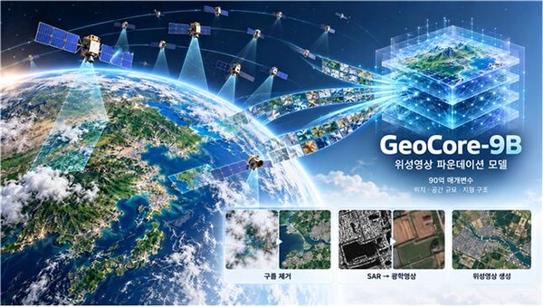
Korea Advanced Institute of Science and Technology (KAIST) said on Oct. 20 that a research team led by Professor Moon-cheol Kim (김문철) of the School of Electrical Engineering has developed an AI model, GeoCore-9B, that can restore satellite images obscured by clouds and convert radar images into ordinary photo-like images.
GeoCore-9B is a generative AI foundation model with about 9 billion parameters. It was developed to be used for various tasks such as generating, restoring and converting satellite imagery.
The team trained the model using 10 million pairs of satellite images from around the world and sentences describing them. Instead of modifying a general photo generation model, it trained the core model from scratch based on Earth observation data such as terrain, forests, ports and cities.
It also incorporated the imaging location and spatial scale of satellite images. The team used latitude and longitude and ground sample distance in training so the AI would consider geographic location and the actual size of terrain. It also applied a "geospatial semantic alignment" technique to learn terrain structures such as road connectivity and the boundaries of farmland.
The team applied the model to cloud removal and conversion of synthetic aperture radar (SAR) images into optical images. In the process it used a method called LoRA, which reduces the training burden by keeping the core model while further training only some parameters.
KAIST said performance evaluations using public satellite data showed the model outperformed existing specialist models on key image-quality indicators for cloud removal. In experiments converting radar images into optical images, it also recorded the best performance on some quality evaluation indicators.
The team expects the technology to increase the usability of satellite data that had been limited by clouds or imaging methods. It plans to expand the research scope to predicting terrain changes such as floods, wildfires, building damage and urban expansion, and to surveillance and reconnaissance technology in the defense sector.
Kim said, "By learning even the imaging location of satellite images and the actual size of terrain, we enabled a single AI to be used for multiple tasks such as cloud removal and image conversion." He added, "We expect it will help assess disaster situations and observe forest and urban changes."
The research listed Jung-hyuk Do (도정혁), a PhD researcher at the KAIST Institute of Information and Electronics Research, as first author, with Kim as corresponding author. The results were accepted to the international AI conference NeurIPS 2026.
 Jin-ho Lee
jhlee26@d-today.co.kr