
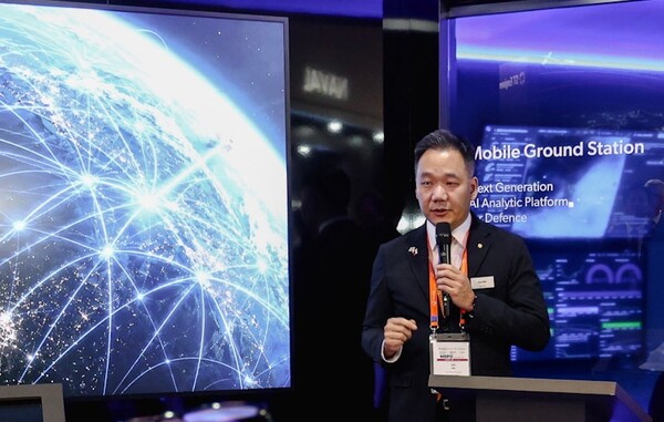
Hanwha Systems has for the first time launched overseas a technology that uses AI to analyse satellite imagery. Hanwha Systems said it held a “space AI solution launch event” on Sept. 9 local time at MSPO 2026, Eastern Europe’s largest defence industry exhibition, in Kielce, Poland. In a session attended by officials from the global space and defence industries, it demonstrated AI interpreting in real time imagery of Eastern Europe filmed by an operational satellite.
The solution precisely interprets image data sent by satellites to ground stations using AI and provides summaries of key information. AI functions include automatically detecting objects, analysing situational patterns and detecting anomalies to support commanders’ decision-making. A key feature is that it integrates the entire process into a single system, from imagery collection to AI analysis and decision support.
The technology can be used to precisely track an adversary’s military movements and routes. When disasters occur, it analyses changes in buildings and terrain in key areas to quickly calculate the scale of damage before and after the event. It supports analysis of both electro-optical, or EO, satellites and SAR satellites, which create images by transmitting electromagnetic waves and using the reflected signals. It also fuses the two sets of data to generate insights by situation.
The company also addressed a problem with SAR satellites: their black-and-white radar images are difficult to interpret with the naked eye. The space AI solution identifies aircraft, ships and vehicles in SAR imagery in seconds and improves resolution. It also complements those limitations by fusing SAR data with imagery from high-resolution EO satellites. The company said it expects the solution to increase the usefulness of its lineup of small SAR satellites with 1 metre, 0.5 metre and 0.25 metre-class resolution, as well as an under-development very low Earth orbit, ultra-high-resolution SAR satellite with 0.15 metre-class resolution.
A dedicated interface linked to Hanwha’s strike systems and fire control systems, including the K9 self-propelled howitzer and Chunmoo multiple rocket launcher, has also been implemented in the solution. It is expected to increase operational efficiency across Hanwha weapons systems by connecting satellite reconnaissance to strike capabilities.
A Hanwha Systems official said the space AI solution is a world-class technology that integrates analysis of EO and SAR satellite imagery, transforming the value of satellite data beyond simple collection into immediate reconnaissance and tactical intelligence. The official said it would complete a proprietary “space-ground integrated infrastructure” linking very low Earth orbit SAR satellites and space AI data centres, in step with space investments being pursued by Hanwha Group, and would lead the global defence and space markets.
 Daegeon Seok
d2dg@d-today.co.kr
Daegeon Seok
d2dg@d-today.co.kr